
Mountain Mapping is a GPS data collection and asset inventory company. We specialize in mapping large and complex networks of utilities and other infrastructure.
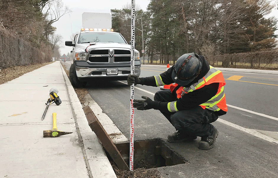
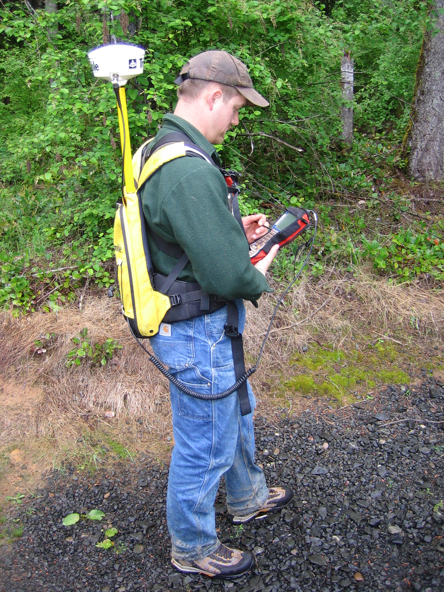
We use a small office to manage multiple field crews and expansive projects for energy and utility companies and environmental/disaster response. Our field staff use Trimble Mapping Grade GPS receivers and software to capture accurate data about the exact location, attributes and condition of all sorts of assets and infrastructure.
Mountain Mapping has mapped public lighting in counties, communication systems on military bases, sewer manholes in cities, power poles in rural areas, street signs in small towns, power poles in the mountains and even coral reefs in the ocean and oil wells in the desert.
What can we map for you?
Our clients employ our data for myriad purposes – whether you need to:
- inventory your assets,
- meet agency compliance regulations or
- plan future infrastructure upgrades
you need to know what you have and exactly where it is.
Our GPS systems are capable of resolving horizontal accuracies from sub-meter all the way to sub-centimeter and verticals down to about 2cms. Data can be delivered in any coordinate system and datum combination, and in any format, from standard GIS formats like Geodatabases and Shapefiles, to common formats like KML and KMZ for use with Google Earth and Maps.
While our primary service is to create spatial datasets for agencies and utility and other companies, we can also assist with the setting up of GIS systems for our clients, and even provide cloud-based platforms for browser-based display and analysis of the data we create for you. Imagine the power of showing your board members your data overlaid on a 3D Google Earth interactive map during a meeting, and clicking on a fire hydrant to display its serial number, model and a photograph! Many of our clients also benefit from the simple and affordable field-mapping solutions we offer. Whether your field staff need to identify valve locations, repair damaged signage, or find other work order locations, we can help. We can provide options from basic, no network required, standalone field maps, which users can deploy on phones or tablets, to interactive solutions that allow data updates directly from the field.
Asset Mapping / Infrastructure Planning
“Whether you manage street signage or stormwater systems, fire hydrants or street lighting, parking meters or power poles, MMG can help with data collection and database design, to simplify inventory and planning processes.”
Mountain Mapping has wide experience in database and workflow design for all sorts of utility mapping. Whether the goal is to collect your data in-house, or to have us collect it for you, we can advise on the practicalities of field methodology, realistic expectations for different approaches, and data flow design (into and out of the field.) Our experiences field staff can rapidly and efficiently collect huge amounts of asset data at any required accuracy level, all the way to sub-centimeter positioning. If you are contemplating a large-scale data collection effort, let us lend our wide experience in all utility areas to your planning and implementation. From hardware and software choices, to software selection and licensing options, through field training and database management Mountain Mapping can help with your most complicated projects.
Agency Compliance and Regulatory Requirements.
“Let Mountain Mapping ease the pain of meeting the increasingly demanding regulations surrounding reporting of where your infrastructure is.”
Increasingly, both in North America and around the world, more and more regulatory agencies are requiring map data from utility and other operators, to monitor and gauge public safety impacts of utility operations. Whether it is around power pole inspection and mapping, or stormwater infrastructure networks, if you are not currently required to collect and store location information about your assets you may soon be so required. Get ahead of the curve by talking to Mountain Mapping about how best to meet the needs of your regulating body. Currently different US States and Counties have a wide range of map reporting requirements for all areas of utility and environmental operations. If you are in the Oil and Gas industry in Colorado, for instance, you are now required to submit coordinates for each of your wells to the COGCC. In all States there is increasing scrutiny of stormwater management systems, and the locations of outfalls is becoming more and more widely demanded by states across the country.
Drone Mapping and Aerial Services
“Mountain Mapping can now provide sub-inch resolution aerial mapping of your critical operations infrastructure, and high resolution video inspection of dams, power transmission lines and recreational assets.”
Using cutting edge aircraft and software, MMG’s FAA licensed Part 107 pilots can effortlessly collect acres and acres of map data, and beautiful video footage. We currently map golf courses, both to aid groundskeepers and enhance the golfer experience – building whole GIS systems with connected mobile apps for Android and IOS platforms. We also provide 3D modeling services to the Oil and Gas industry, particularly in the environmental side of the industry. If you have to measure volumes of materials, or excavations, or make accurate report maps for work you have completed, Mountain Mapping can easily and affordably provide all the data and imagery you need.